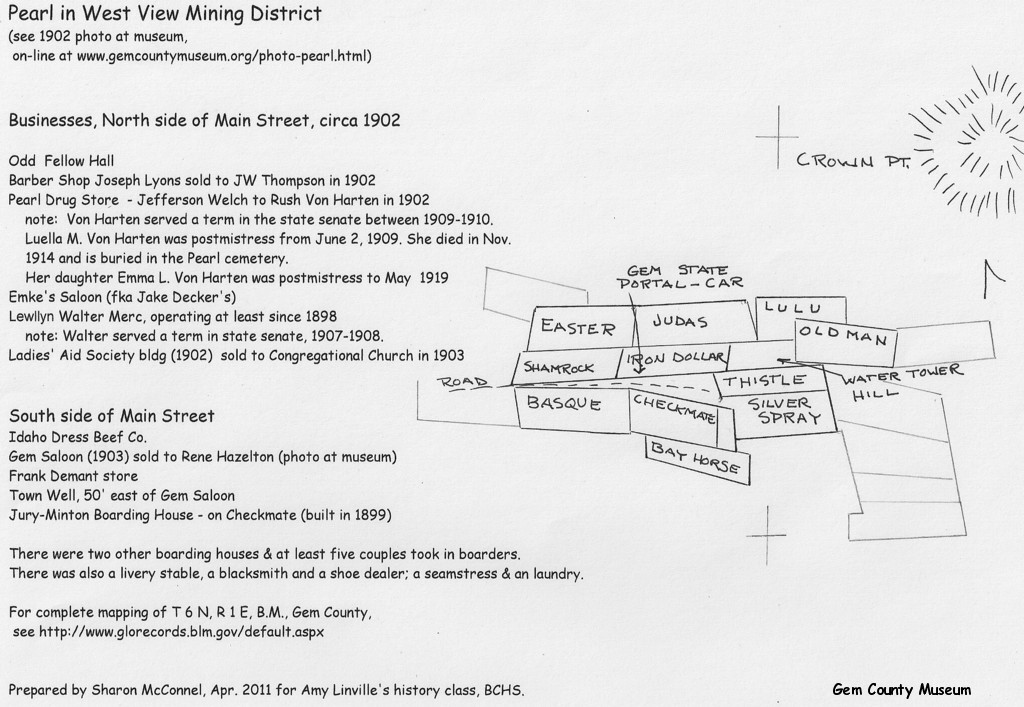
Pearl 1902 (reconstructed)
Note: This is all private property.
(click to enlarge)
This map was drawn to accompany the 1902 Pearl photo in the museum collection, which was taken from "water tower hill", looking west, down Willow Creek.
The patented mining claims were copied from the Metsker's Atlas of Gem County. For complete mapping of the patents in Township 6 North, Range 1 East, B.M., Gem County, see The Official Federal Land Records Site of Bureau of Land Management.
The business owners' names were taken from leases and transfer of leases, Gem County Public Records. The information on other businesses was taken from 1900 census transcript by ISU.
Idaho Blue Book, 2007-2008 gives the senate terms of Rush Von Harten and Llwellyn Walters as does other Blue Book issues. The postmaster information was taken from History of Post Offices in Idaho, U.S. Post Office, Gem County Historical Society and Museum Collection (see Post Office History).
While probably not complete, hopefully this gives a bit of the flavor of Pearl in 1902 and gives tips for additional research. The museum has an extensive Pearl collection. Gem County public records (Recorder's Office) and newspaper files (available at Emmett Public Library on microfilm) also have additional information. Happy researching!
Copyright © 2008 - All Rights Reserved.
Unless otherwise attributed, all photos and text are the property of Gem County Historical Society
Serving Gem County since 1973.
Hours
Wednesday - Saturday 1:00pm - 5:00pm
& by appointment :: Extended hours during The Cherry Festival in June.